
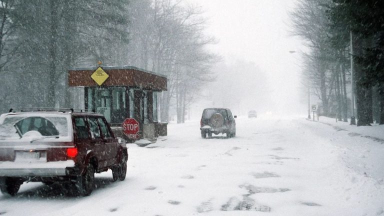
A Winter Weather Advisory is in effect across large portions of Michigan, Minnesota, and Wisconsin, as a snowstorm is expected to bring accumulating snow, freezing rain, and hazardous travel conditions through Monday morning, according to the National Weather Service (NWS).
The advisory spans much of the Upper Midwest, from Michigan’s Keweenaw Peninsula through southern Wisconsin, impacting millions of residents and travelers. Officials warn that roads could become slick quickly, especially during the Monday morning commute.
Key Impacts at a Glance
-
Snow accumulations: 1 to 7 inches depending on location
-
Mixed precipitation: Snow, sleet, and freezing rain expected
-
Road hazards: Icy and slippery conditions likely
-
Travel concerns: Dangerous commute possible Monday morning
-
Public guidance: Avoid non-essential travel if possible
Timing and Areas Affected
The advisory began Sunday afternoon and evening and will remain in effect until midnight to 10 a.m. Monday, depending on the region.
Michigan:
Snowfall of 3 to 7 inches is expected across parts of the Upper Peninsula and Northern Lower Michigan, including Keweenaw, Marquette, Luce, Grand Traverse, Roscommon, and Wexford Counties.
Wisconsin:
Central, northern, and eastern areas — including Green Bay, Door County, and La Crosse — could see 1 to 4 inches of snow, along with a light glaze of ice in several counties.
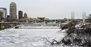
Minnesota:
Eastern Minnesota, including the Duluth area, is forecast to experience a mix of snow, sleet, and freezing rain. Snow totals are expected to be lighter, but travel conditions may still be hazardous.
Snow and Ice Forecast
-
Northern Michigan: 3–7 inches of snow, especially in Luce and Schoolcraft Counties
-
Wisconsin: 1–3 inches of snow with light ice accumulation in central and northeastern areas
-
Minnesota & nearby regions: Less than 2 inches of mixed precipitation, but rapid icing possible
NOAA warns that conditions will worsen Sunday evening, with snowfall rates briefly reaching up to one inch per hour in some areas.
Travel and Safety Warnings
Even after precipitation ends early Monday, icy roads and black ice may persist. Bridges, overpasses, sidewalks, and untreated roads are expected to be especially dangerous.
“If you don’t need to be on the roads, avoid travel after sunset,” said Steve Nelson, an NWS forecaster in Green Bay. “Black ice will be a major concern overnight.”
City-Specific Alerts
-
Green Bay, WI: Advisory from 3 p.m. to 3 a.m.; up to 2 inches of snow
-
Duluth, MN: Reduced visibility at times due to snow and light ice
-
Marquette, MI: Snow totals nearing 6 inches with slick road conditions
Winter Driving Precautions
The NWS urges residents to:
-
Monitor 511 travel updates
-
Carry an emergency kit in vehicles
-
Drive slowly and leave extra stopping distance
-
Avoid sudden braking or sharp turns
-
Stay updated through weather.gov
Residents across the region are advised to stay alert as winter conditions intensify overnight.


Leave a Reply